
Conquering northern Vietnam's breathtaking 'Ha Giang Loop'
In recent years, the “Ha Giang Loop” - a popular motorbike route amongst backpackers visiting Vietnam - has allured travelers with its majestic mountainous landscapes and spectacular views of the northern Vietnamese province.
 |
Though travelers can reach Ha Giang by passenger buses or private car, motorbikes seem to be the most preferred method by the throngs of backpackers who visit the country each year.
Tran Phuong, a Tuoi Tre (Youth) newspaper journalist, drove the Ha Giang Loop with a group of friends and returned with dozens of stories and hundreds of pictures.
According to Phuong, backpacking through Ha Giang is not too difficult, whether you’re a regular backpacker or an office worker with little backpacking experience.
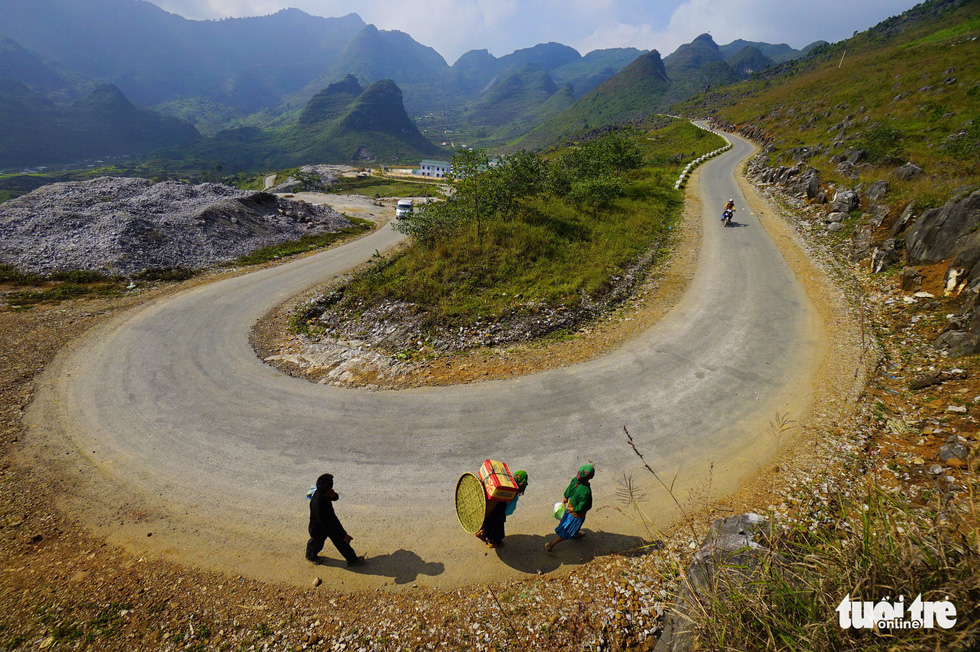
Snaking through the windy roads in Ha Giang requires caution, but the reward of experiencing the epic mountainous scenery and impressive terraced fields typical of the northern region is a major payoff.
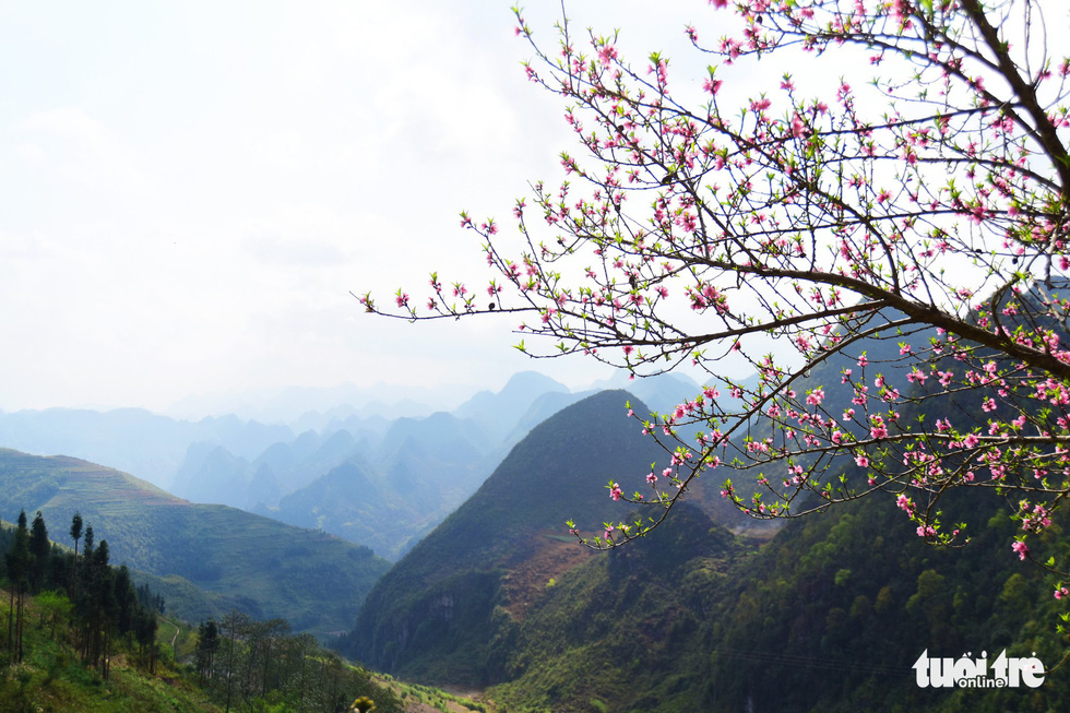 |
| Peach blossom bloom in Dong Van District, Ha Giang Province, Vietnam. Photo: Quang Dinh / Tuoi Tre |
A ride to Ha Giang also includes a course through the Ma Pi Leng mountain pass, widely regarded by travelers as one of the ‘Great Four’ mountain passes in northwestern Vietnam thanks to its hair-raising bends and magnificent landscapes.
One of the most popular lookout points for travelers along the route is when they reach the 1,500 meter elevation point along the 20-kilometer mountain pass, where they are able to stop and admire the poetic beauty of the jade-colored Nho Que River below.
Spending a night at a homestay in Lung Cu Commune, in Dong Van District, home to the local Lo Lo people, one of Vietnam’s 54 ethnic minorities, and enjoying homemade hotpot and a cup of tea after a day traveling by motorbike are few of the best options to unwind in this mountainous region, Phuong suggested.
A morning in Lung Cu often begins with a climb up 500 steps to reach the top of the Lung Cu Flag Tower, a northern landmark which marks Vietnam’s national sovereignty.
Another must-visit destination not far from Lung Cu is the scenic UNESCO-recognized Dong Van Karst Plateau Geopark, one of the world’s most unique rock formations.
Below are some photos of the magnificent Ha Giang Loop:
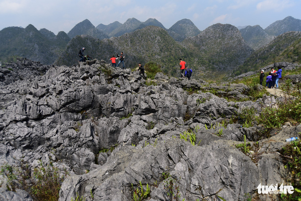 |
| Tourists visit Dong Van Karst Plateau in Dong Van District, Ha Giang Province, Vietnam. Photo: Quang Dinh / Tuoi Tre |
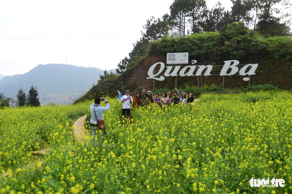 |
| Visitors pose for a photo among a field of lettuce flowers in Quan Ba District, Ha Giang Province, Vietnam. Photo: Quang Dinh / Tuoi Tre |
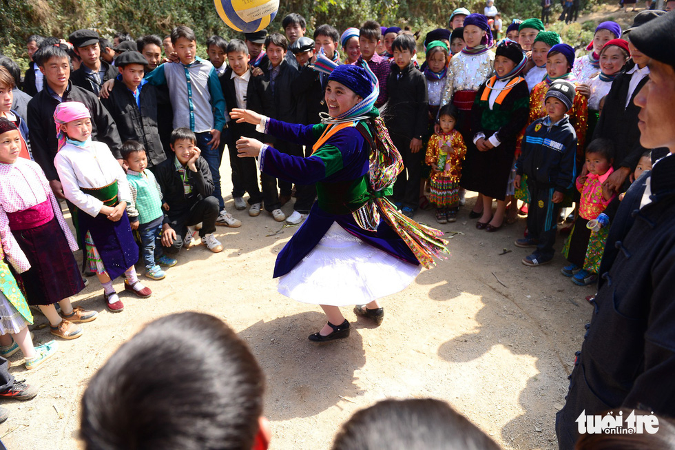 |
| People gather around a dancing ethnic woman in Dong Van District, Ha Giang Province, Vietnam. Photo: Quang Dinh / Tuoi Tre |
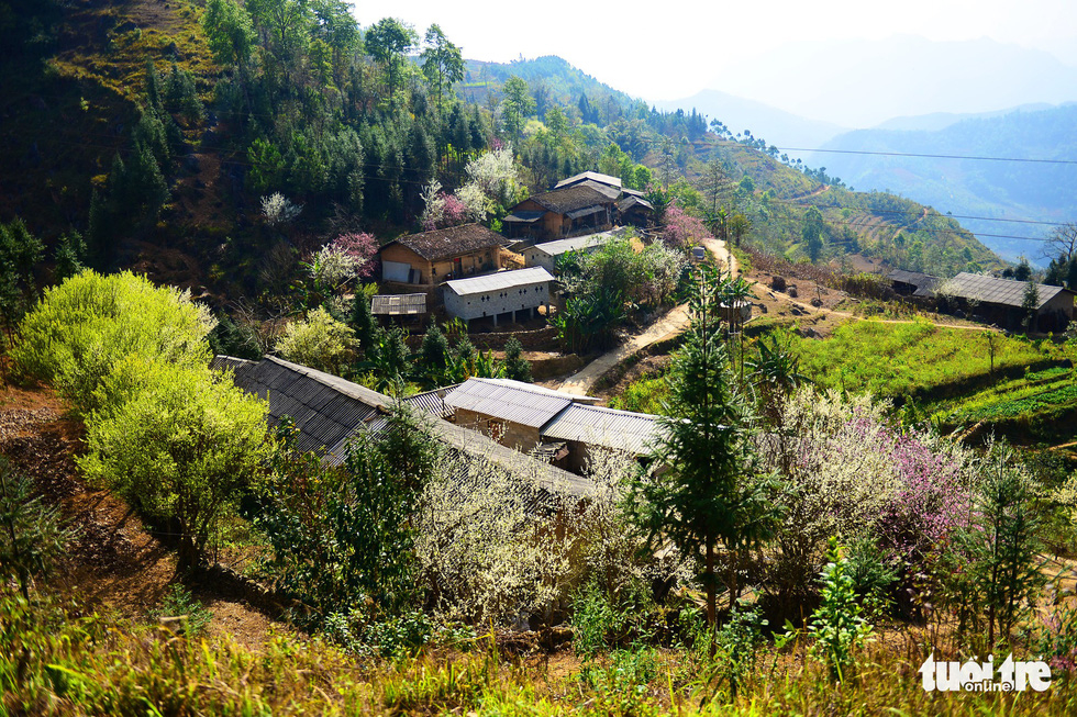 |
| Local houses in Dong Van District, Ha Giang Province, Vietnam. Photo: Quang Dinh / Tuoi Tre |
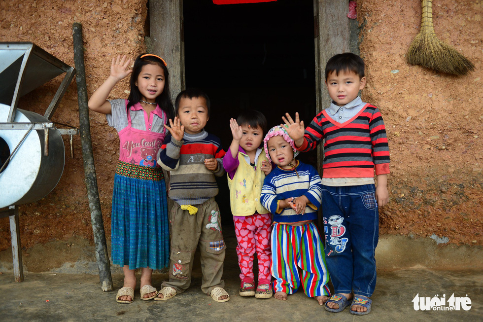 |
| Local children at their house in Quan Ba District, Ha Giang Province, Vietnam. Photo: Quang Dinh / Tuoi Tre |
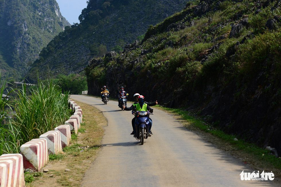 |
| A group of young people ride motorbikes from Hanoi to Ha Giang. Photo: Quang Dinh / Tuoi Tre |
 |
| An aerial view of local people’s houses in Lung Cu Town, Dong Van District, Ha Giang Province, Vietnam. Photo: Quang Dinh / Tuoi Tre |
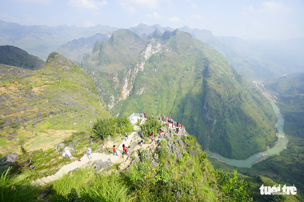 |
| A view overlooking the Nho Que River from the highest point of Ma Pi Leng mountain pass in Meo Vac District, Ha Giang Province, Vietnam. Photo: Quang Dinh / Tuoi Tre |
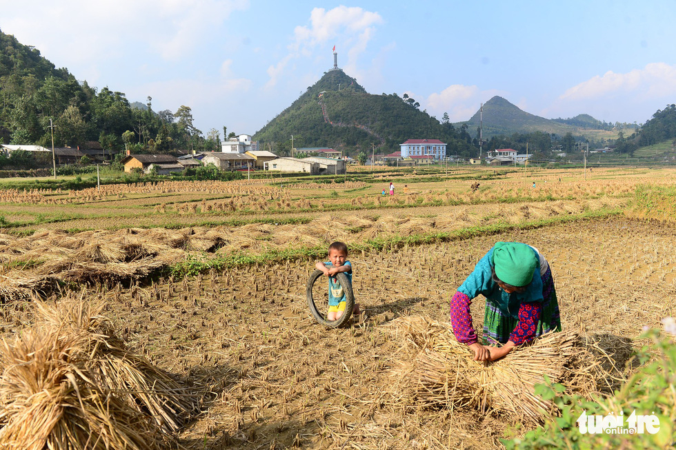 |
| A woman collects straw after the harvest while her son plays nearby in a field in Lung Cu Commune, Dong Van District, Ha Giang Province, Vietnam. Photo: Quang Dinh / Tuoi Tre |
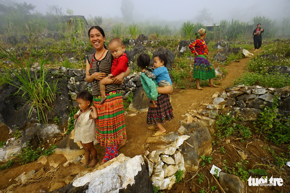 |
| Women babysit their children in a small town in Dong Van Karst Plateau, Dong Van District, Ha Giang Province, Vietnam. Photo: Quang Dinh / Tuoi Tre |
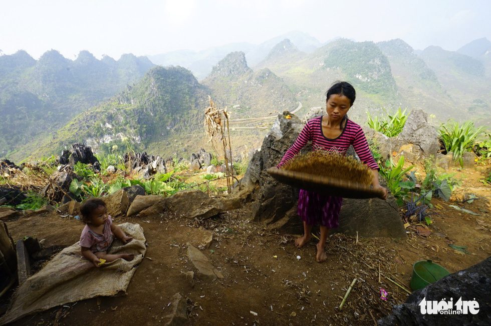 |
| A woman does household chores while her child sits nearby in Dong Van District, Ha Giang Province, Vietnam. Photo: Quang Dinh / Tuoi Tre |
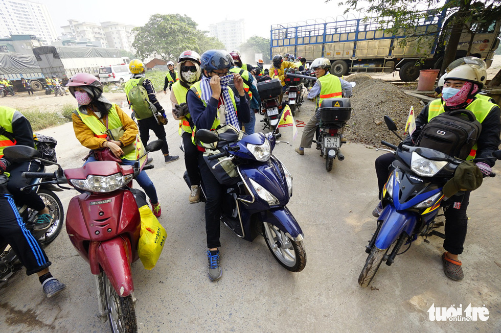 |
| A group of youth rest during their trip from Hanoi to Ha Giang. Photo: Quang Dinh / Tuoi Tre |
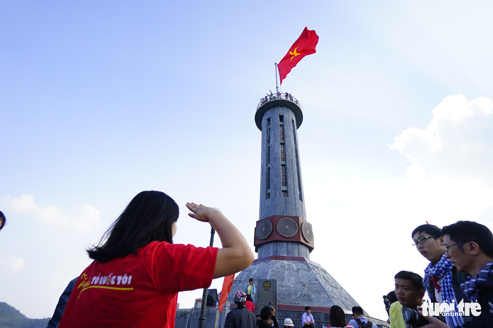 |
| Lung Cu Flag Tower in Dong Van District, Ha Giang, northern Vietnam. Photo: Quang Dinh / Tuoi Tre |
Like us on Facebook or follow us on Twitter to get the latest news about Vietnam!
source Tuoi Tre News


READER COMMENTS